Abergwyngregyn to Y Felinheli – Wales Coast Path

« of 2 »
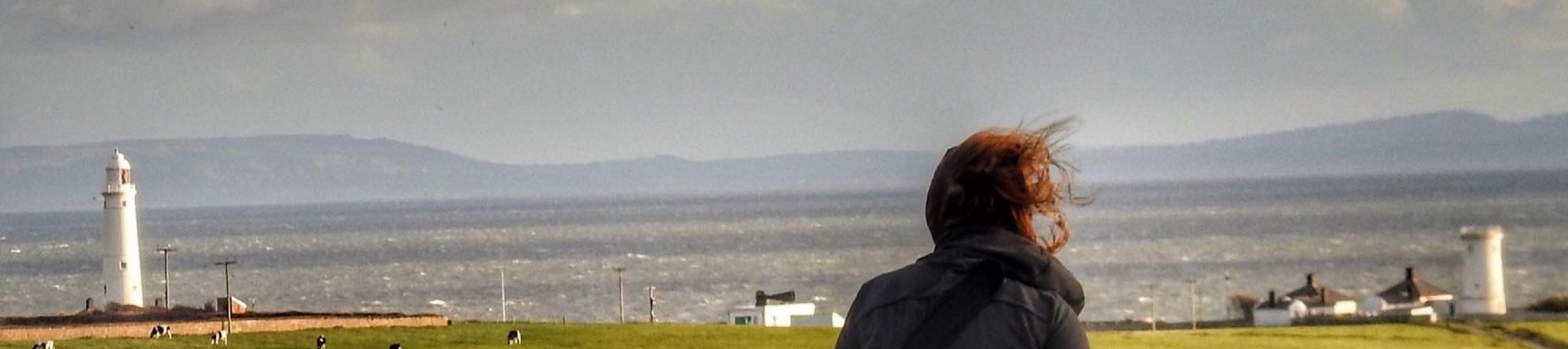
Today is the day we complete the path on the mainland of Wales. We want to complete our journey around the Wales Coast Path path on the Isle of Anglesey.
Little did we know that our 12 mile  walk would stretch to fifteen as the day went by.
An early start, the morning mist still hangs in the air as we parked the car at the nature reserve below Abergwyngregyn.  We set up quick a pace along Traeth Lamar quickly reaching the Spinnies nature reserve.
Note to self:  the nature reserves from Llanfairfechan to the Spinnies are well worth another visit!
We see Penrhyn Castle in the distance, and for much of the next hour we skirt the estate – so much nicer if we could have cut through the property rather than detour through to Talybont and Bryn.
Somewhere crossing the main road from Bryn we lost sight of the signs and had to tack back a couple of times before reaching Porth Penrhyn, where the slate from Penrhyn Slate Quarry used to be transported. First by railway from the quarry to the port and onwards.
We continue up the junction to the A5 and reached the Garth in Bangor with its impressive Pier. On optical illusion has you thinking that the pier reaches out as far as Anglesey – not the case.
The path does not go into Bangor,but descends to the shoreline and follows along towards Nant Borth nature reserve, through woodland then up passing a ruin and then a soccer training ground.
Back out on the A5 we head for Menai Suspension bridge, and the road to Anglesey. We continue towards the Britannia Bridge, opened in 1850 and designed by Robert Stephenson as a rail bridge. It was only in the 1970’s that it was adapted to take both road and rail traffic.
We continued left where the path heads right up to the A487, seeking the more attractive route, connecting again at the Faenol Estate. We followed the signs through the estate and found that in heading right up the field as directed there was no obvious route.  We asked some local walkers and they directed us back down the field to follow a well cut path by the straits – they said it would take us to Felinheli.  What they didn’t say was that we would be confronted by a 5 bar gate topped with a five bar metal structure. We retraced our steps only to confront another sign saying KEEP OUT.  Fortunately the owner arrived, and kindly pointed us in the right direction, and after a bit of manoeuvring we arrived at our final stop.  A robin popped his head out, as if to say “well done ladies”
Lucy’s comment of the day “the Path really doesn’t want to let go of us”
At this stage, the Wales Coast Path has developed a personality of its own!

Y Felin Heli to Caernarfon – Wales Coast Path

The Felinheli or Port Dinorwic as it is often referred to in English sits on the mainland Wales side of the Menai Straits. It is our home for the next few days as we tread the Wales Coast Path once again.

A taxi driver tells us that Felinheli means Salt mill – Felinheli = Mill, Helo = salt water or brine. Then again the name could mean the mill on the Heulyn, which is the river that runs through the village.

The small modern marina is a far cry from the days when slate from the nearby Dinorwic quarry used to be transferred by rail to the Quay then loaded and shipped

We arrive late afternoon, so a short four mile walk to Caernarfon to limber up for the next few days,followed by dinner seems a good idea.

The walk itself is not the most inspiring, it wasn’t an auspicious start as we turned right up Hen Gel Llechi instead of left!

Soon corrected, we soon accessed the A487 before we linked into the cycle path for the four mile stretch into Caernarfon.

In Caernarfon we headed to our favourite pub – The Black Boy. On the wall, the sign tells us that this used to be the red light district, the Welsh name for the street – Stryd Pedwar a Chwech – Four and Six Street. In old shillings and pence, a sailor could get a room, a woman and a bottle of gin for this price….

The taxi driver taking us back to Felinheli couldn’t understand why it was so busy for a Thursday, he was worried he wouldn’t get to his stir fry supper until around 10 pm, and by then he would probably settle for a corn beef sandwich! I love Caernarfon!

Dinas Dinlle to Caernarfon – Wales Coast Path

« of 2 »

We left our lovely apartment in Abersoch to stay in Caernarfon. The weather forecast is mixed, so we are going to complete the next two walks within easy reach of our temporary home base.

This walk is at low levels, no major inclines to target. I am not a fan of walking on roads, but much of this stretch is along tarmac,but comfortable, easy walking after a few more challenging walks.

Leaving Dinas Dinlle follow the paved path along the shore line and eventually turn right passing the Caernarfon Airworld Aviation Museum. As you approach the caravan park don’t follow the road but carry straight on into a grassy lane, then left to take you all the way around to a footbridge over Afon Carrog, eventually heading by road inland to Saron. We had a water stop on the bridge over Afon Gwyrfai.

Our favourite part of this walk was alongside Foryd bay, a great spot for bird watchers. Today was not a day for spotting the difference between a widgeon or a wild fowl. A brisk wind is blowing, rain is in the air, but stopping for a chat with a local farmer he told me we would make it to Caernarfon before the rain.

Nothing can prepare you for the sight of Caernarfon’s walls and Edward 1 castle. Caernarfon was the scene of Prince Charles’s investiture as the Prince of Wales.

We didn’t head for the mighty castle, but the Bar Bach, the smallest bar in Wales for a shot of Penderyn Whiskey to warm us up.

Sure enough, snug in the bar the winds roared and the sky opened. Nothing for it but to have dinner at the Black Boy.

Dinas Dinlle to Trefor – Wales Coast Path

« of 2 »

I have struggled to find many positives in this walk.

You turn your back on Dinas Dinlle and head for the main road – the A499 and most of the route straddles the busy main road.

An easy walk with excellent paved path which also doubles as a cycle route. Occasionally taking the old road through villages and then returning to the A499

Be alert, having passed the junction for Penygroes, at the next junction you need to turn left and then right.

The highlight of the route is St Bueno’s Church at Clynnog Fawr. A great example of a Tudor Church, almost cathedral in size. Sir Clough Ellis Williams who masterminded Portmeirion said that this church inspired him to be an architect. Well worth a visit.

A little further along is St Bueno’s Well, one of the healing wells in Wales.
We are following in the steps of pilgrims travelling to Bardsey and the church and well remind us of the religious significance of this route.
We were very relieved to turn off the main road towards Trefor and the final mile of the walk.

Nantgwrtheyrn to Trefor – Wales Coast Path

« of 2 »

This short hike completes the 106 miles (270.5km) of the Lleyn Peninsula, having walked from Trefor to Caernarfon on a previous trip to North Wales.

Conscious of the 4 hour journey home, we were tweeting the sunrise to various media channels, before setting off up the from the car park at Portu Nant. This path is like the A470 in comparison to the previous couple of days.

There isn’t a soul around, there is a biting wind, looking down we can see the Welsh language and heritage centre in the valley below, and the steep hill we had dragged our sorry selves up previously.

We climb steadily to Bwlch yr Eifl before extending our walk up towards the microwave station to take in the views across North Wales.

Lucy compares me to her Dad as I am now using her walking pole to point out various landmarks. It sounded to me that the O’Donnell children were lucky not to have their eyes poked out through Mr. O’D’s enthusiastic use of his stick.

On that highest point on the Wales Coast Path, we parted company, me heading up hill to the Eifl (564 mts) and Lucy downhill towards Trefor. By the time I reached the top the low cloud had obliterated any views, it was very Game of Thronesish up there, swirling low clouds. Where is Jon Snow? I abandoned the Trek to the Iron Age settlement of Tre’r Ceiri to another day.

Heading downhill was harder going – the loose stones giving way under foot, annoyingly as I picked up the path again, the sun came out.

Just passed Bwlch yr Eifl I stopped to chat with a group of walkers from Prestatyn, reflecting that I was glad to be going down the hill, rather than an upward climb from Trefor.

Coming off the moor I pass a ruined miners cottage, and from then on it is an easy walk down the path, then a lane across a couple of fields. At the road I take a left the next sign makes you think that you are heading back up the mountain towards the brooding Eifl Granite Quarries, but the path takes you on a dog leg passing the white washed West End cottages, to a very pleasant stretch along the cliffs to the pretty harbour at Trefor.

Morfa Nefyn to Nant Gwrtheyrn – Wales Coast Path

« of 2 »

We dithered this morning – not quite sure whether we could hack a climb up the Eifl mountain, after our time struggling with the mud the previous day.

We settled for a walk to Nant Gwrtheyrn stopping for longer breaks than usual. For the first time ever I am using a walking pole, kindly supplied by Lucy, to take the stress off my bruised hip. I have been a bit anti walking poles, but today I become a convert.

A short stroll from our apartment we access the steps leading to a well defined path across to the tiny headland at Penrhyn Nefyn and onwards to the small fishing harbour of Nefyn. In 1284 the English King Edward 1 held a jousting tournament in Nefyn when he defeated us Welsh. St Mary’s Church would have been on the pilgrimage route to Bardsey Island.

The path heads inland, we ignored the notice saying the path was closed, and we had no difficulty in walking onwards until we reached the main road on the outskirts of the village of Pistyll. Turning left, cross the road and follow the signs.

We pass a little church in a hollow, where Rupert Davis, the actor who played Maigret is buried.

We walk on above Porth Pistyll to Penrhyn Glas, we spy a sheep precariously clinging to the side of a rock, before climbing up to a ridge, then downwards through an ancient forest, you would expect to see goblins and wizards appear at any moment.

At Porth y Nant remains of the granite quarry is clear to see, although the working men’s cottages and allied buildings are now home to Nant Gwrtheyrn Welsh language and Heritage Centre. King Vortigen – King of Britain – 5th century – hid here from his enemies, and if you are interested do look up the legend of the Three Curses and the tragic love story of Rhys and Meinir.

Once at the Nant we had the hard slog up the hill to the car park, passing the creaking, groaning pine trees. A thoroughly satisfying day!

Porth Ychain to Morfa Nefyn – Wales Coast Path

« of 2 »

Had you ever heard the Hippopotamus Song by Flanders and Swann. The chorus goes something like-

Mud, mud glorious mud
Nothing quite like it for cooling the blood
So follow me, follow Down to the hollow
And there we can wallow in glorious mud.

It sums up the day!

To fully appreciate the striking scenery this section is probably best experienced between late Spring and Autumn not in the height of winter following a period of rain. The path mainly consists of disparate tracks, little more than sheep tracks, the mud is congealed. We were grateful for the sturdy farmers’ fences which gave us leverage on a number of occasions. The path follows the low lying cliffs, while normally I loathe steps, this time they are a welcome relief from the relentless slog!

At Porth Ysgaden, we explore the remaining wall of a lime kiln, the tin sheds at Porth y cychod are a source of curiosity, passed the popular beach at Porth Towyn -Tudweilog is easily reached from here, and it has been our intention the previous day to end our walk here.

Somewhere between Penrhyn Cwmistir and Aber Geirch we came across a colony of spotted seals …such a delight, I could have stayed watching for hours.

In startling contrast to the early stages of this walk is the appearance of Nefyn golf course in the distance, a bit of a scramble to access the course from the river below but welcome relief to skirt the edges of this beautifully manicured course.

Around Trwyth Porth Dinllaen and down to one of my favourite beaches in Wales – Porth Dinllaen. Unfortunately, The Ty Coch pub are on winter hours and wasn’t open!

One final walk across the bay to Morfa Nefyn and our bed for the night! Two further falls in the mud for me, and Lucy sinking into deep glutinous mud, but a fabulous if tiring day nonetheless.

Porthor to Porth Ychain – Wales Coast Path

« of 2 »

A day of long shadows and bright winter sunshine, we had an early start, parking in the National Trust car park at Porthor (Whistling Sands) we set off at a brisk pace and it was all pretty straight forward along the cliff tops to Porth Iago.  We were soon to slow down as we made our way gingerly through the muddy tracks.

The joy of winter walking is that you hardly see a soul, the down side is you have to make do with sometimes adverse conditions. Progress was slow.

I know I have been known to complain when the path diverges inland, not the case here as the path closely follows the low shore line.

The path continues to Porth Widlin the setting for Wales’s very own Whiskey Galore when the Stuart laden with a cargo of whiskey went down here in 1901 – the whiskey was soon carted away by locals.

At this stage, having decided that I had been focusing so hard on the walk, I stopped to take in the achingly stunning scenery and fell! Whoomph! My first reaction was to save my camera! I was so annoyed with self – after carefully negotiating through the mud slick to fall while standing in one place.

The Lleyn scenery does not disappoint. Lucy and I are in constant awe, reflecting on the remoteness, the proximity to the sea, and the solitude.

There is a little harbour at Porth Colmon (small car park and access inland here) eventually leading own some steps and crossing the stream to cross Penllech beach. A few up and downs later we decide to leave the path at Porth Ychain- night was drawing we walked inland to Tudweilog, rather than be caught out on the headland in the dark.

Porthor or Porth Oer/ Whistling Sands to Aberdaron – Wales Coast Path

« of 2 »

This is the wildest, most remote and breathtaking (in both sense of the word). The views are spectacular, there are quite steep gradients, a totally engrossing walk.

We started from the National Trust car park in Porthor. Walk between the toilet blocks( thankfully open), onto the path. You are almost immediately out onto the cliff top path, leading to the heathland of Mynydd Anelog, down by an old wall , a little dog leg and down towards Porth Llanllawen. The path wanders nicely along the Coastal inlets.

Where there are gaps in the way mark signs, just follow the most defined path, up Mynydd Mawr. This is a steep walk, at one stage it looks virtually perpendicular. At one stage you think you have reached the top, but there is more climbing to follow, until you reach the coastguard station.

Once you reach the summit, there are splendid views across to Bardsey Island – it is reputed that 20,000 saints are buried on the island. It is quite thought provoking to think you are walking in the footsteps of pilgrims.

The concrete road leading away from the coastguard station provides an easy descent, and the path takes you close to the edge around Braich y Pwll, the very edge of Wales- no sign here to indicate we at “Wales End”.

Following on over the common and then a rocky patch we
didn’t go in search of St Mary’s Well, blessed by the Virgin Mary, so says the legend, it was blustery and I was a bit reluctant to go near the shore line.

The only place where we felt an additional sign would have been useful was at Pen y Cil, where the natural instinct would be to turn inland, but the path actually continues passing a cairn on the right.

Turning towards Aberdaron, we were glad to be sheltered from the wind. There is a steep walk down into Porth Meudwy, where the boats cross the sea to Bardsey in the summer, followed by a flight of steep steps up the other side.

It wasn’t long before we were walking down the steep set of steps to the beach at Aberdaron. We took one look at the steep steps leading up to the headland, and decided to walk across the beach to the village, and take our chances with the stream dissecting the sands.

Aberdaron to Llanengan – Wales Coast Path

« of 2 »

Depending on which mileage chart you read, this walk is either 11 miles, 12.5 miles, or according to Louise’s fitness tracker we had walked 14 miles. The only certainty is that it was the muckiest winter walk since starting on the Wales Coast Path.

An early morning drive from Abersoch to Aberdaron certainly made us appreciate the remoteness of this part of the Lleyn, and also it’s raw beauty.

Aberdaron is a small wind swept seaside village, with mainly white washed houses. The National Trust membership has helped with the parking fees in this part of Wales yet again.

We had a debate at the Spar as to which direction to take, our guide book soon put us right, and we turned into a field and were on our way.

The path as far as Porth Yago was well defined if somewhat wet. The industrial ruins add to the atmosphere.

The lane leading up to a guest house is covered with deep mud, and the electric fence running along side seems forbidding.

It was after the iron gate leading out of the farm yard that the confusion began. The book says turn left, the signs mark the route as straight on and with one sign pointing randomly towards the heath.

We went straight on – only to come to a superb view point looking out on Bardsey Island, but no clear indication of the path.

Louise went over the top, Lucy and I retraced our steps to the gate to follow the guide book.

A helpful gentleman walking his dog told us that up ahead was very muddy, better take the road or stay high on Mynydd y Graig which we did, and the signs are clear again.

We cover the track to Rhiw fairly quickly. A helpful National Trust volunteer at Plas y Rhiw told us that it was impossible to access Hell’s Mouth beach further down the road, as there had been a landslide. His suggestion was to go passed the National Trust car park and follow the lane. He warned us that the beach boulders were very slippery and to take care. He was right.! We slid and slipped our way across to the long sandy stretch, with the very vulnerable crumbling cliffs to our left we walked the rest of the way along the beach.

The WCP takes you inland, but what a shame to miss out on Porth Neigwl/Hells Mouth.

Three tired women picked up the path again at the end of Hells Mouth and made our way to the Ship Inn to pick up the car. Catching sight of the super moon as we ended a long day.